

MyLifeElsewhere compares countries and cities around the world, including cost-of-living information contributed by users.
MapFight
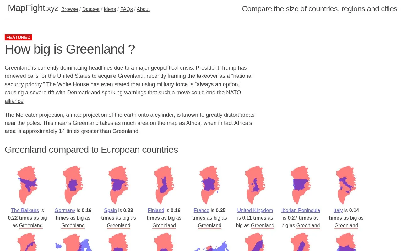
MapFight compares the size of countries, regions, and cities, with maps, datasets, and comparison ideas.
About MapFight
MapFight is a web-based educational tool focused on geography and humanities learning that lets users compare the size of countries, regions, cities, and other geographic land areas. It uses side-by-side visual maps and numerical ratio data to show clear, real-world scale differences between locations.
The platform offers pre-compiled comparison datasets, curated suggested comparison ideas, and context on common map projection distortions, such as the Mercator projection’s tendency to overstate the size of polar regions. It is designed for students, educators, and casual geography enthusiasts who want to correct widespread misconceptions about land area sizes that arise from standard, distorted map views.
Key features
- Side-by-side visual map comparisons of geographic land areas
- Pre-compiled datasets of country, region, and city size comparisons
- Curated suggested comparison ideas for exploration
- Explanations of map projection distortions like Mercator inaccuracies
Best for: It is best suited for students, educators, and geography enthusiasts seeking to visualize accurate land area sizes and understand map projection biases.
Good for
- Clear visualizations make geographic size differences easy to understand
- Addresses common misconceptions from standard distorted map projections
- Provides ready-to-use datasets and comparison ideas for learning
MapFight at a glance
- Website
- mapfight.xyz
- Category
- Education & Learning › History & Humanities
- Type
- Website
- Pricing
- Not confirmed. Check the site
- Platforms
- Web
- Open source
- Not stated
- Last checked
- Oct 5, 2026 · Online when checked
- Listed
- Oct 5, 2026
MapFight alternatives
Tools and sites you could use instead, ranked by how closely they match.

True Size of Countries explains country scale comparisons and answers questions about map size.

Country Infographics provides maps and comparisons including speed limits and vehicle license plates.

If It Were My Home compares living conditions between countries and explores differences tied to birthplace.
The True Size lets users drag, drop, and rotate countries to compare their map projections.

The World Flag Chart organizes flags from countries and regions, including Oceania and the Pacific.
Popular in History & Humanities
Well-known listings from the same topic.
Stanford Encyclopedia of Philosophyplato.stanford.edu/index.htmlPessimistsArchivepessimistsarchive.orgVGA Museumvgamuseum.infoABookOfCreaturesabookofcreatures.comU-boat Archiveuboatarchive.netGovTrackgovtrack.us


MapFight FAQ
What is MapFight used for?
MapFight is a web tool that compares the size of countries, regions, cities, and other geographic areas using maps and numerical data.
Why do standard maps often show incorrect land area sizes?
Common map projections like Mercator stretch areas near the poles, making high-latitude regions appear larger than they are relative to lower-latitude areas.
What comparison options are available on MapFight?
Users can access pre-made size comparisons for countries, regions, US states, cities, and natural features, plus curated comparison ideas.
Is something wrong or out of date?
Tell us and an editor will check it.
Own this website?
Claim this listing
Claim the listing and suggest updates yourself. An editor checks every claim first.