
The True Size lets users drag, drop, and rotate countries to compare their map projections.
True Size Of Countries
True Size of Countries explains country scale comparisons and answers questions about map size.
About True Size Of Countries
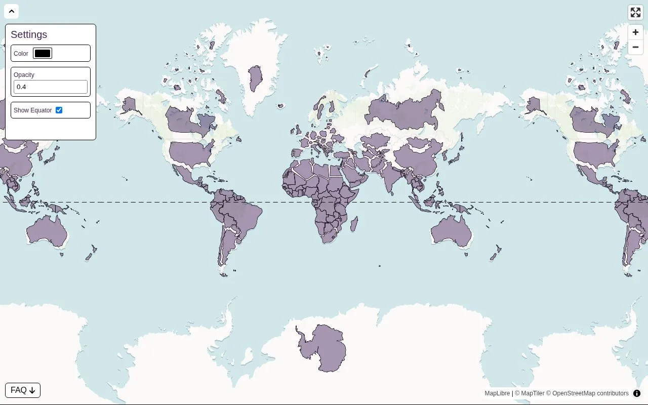
True Size Of Countries is a free web map that shows the actual size and shape of each country on a Mercator projection. The Mercator projection, created in 1569, was widely used for sea travel because it draws shortest paths as straight lines. Its trade-off is distortion: shapes and sizes are largely distorted, the effect is small near the equator, and it increases toward the poles. The site cites Greenland, which appears nearly fourteen times its actual size on this projection. The site overlays the correct outline of each country so users can see how the world would look without that distortion.
Users can adjust the display. The settings menu, opened from the icon in the top left, lets users change country color, enter a color in formats such as rgb, hex, or rgba, set opacity from 0 to 1, and hide or show the equator, which is shown by default. The site describes its map as one of the most accurate 2D world maps, and states that it is free.
Key features
- Overlays true country shapes and sizes on a Mercator base map
- Color picker that accepts pasted values in rgb, hex, and rgba formats
- Opacity setting with accepted values from 0 to 1
- Option to hide or show the equator, shown by default
- Custom maps can be shared by copying the page URL
Best for: Students, teachers, and general readers who want to compare the real size of countries and learn how map projections distort area.
Good for
- The site states that it is free to use
- Display settings such as color, opacity, and the equator can be adjusted
- Custom maps can be shared by copying the URL
Watch out for
- The base map is a Mercator projection, so shapes and sizes are distorted, especially toward the poles
True Size Of Countries at a glance
- Website
- truesizeofcountries.com
- Category
- Education & Learning › History & Humanities
- Type
- Website
- Pricing
- Not confirmed. Check the site
- Platforms
- Web
- Open source
- Not stated
- Language
- English
- Last checked
- Oct 6, 2026 · Online when checked
- Listed
- Oct 5, 2026
True Size Of Countries alternatives
Tools and sites you could use instead, ranked by how closely they match.

MapFight compares the size of countries, regions, and cities, with maps, datasets, and comparison ideas.

The Food Timeline researches food history and answers questions about what people ate in different eras.
Wealth, Shown to Scale visualizes differences in wealth using comparisons from household income to billionaire fortunes.

Country Infographics provides maps and comparisons including speed limits and vehicle license plates.

WorldData.info provides country statistics, comparisons, and rankings across geography and demographics.
Popular in History & Humanities
Well-known listings from the same topic.
Stanford Encyclopedia of Philosophyplato.stanford.edu/index.htmlGovTrackgovtrack.usVGA Museumvgamuseum.infoPessimistsArchivepessimistsarchive.orgABookOfCreaturesabookofcreatures.comU-boat Archiveuboatarchive.net


True Size Of Countries FAQ
Is this website free?
The site states that it is completely free and says it will always stay that way.
How do I hide the equator?
Open the settings using the icon in the top left of the screen, then uncheck the equator box to hide it from the map.
How can I share a custom map?
Copy the URL of the map and send it to anyone you like.
Is something wrong or out of date?
Tell us and an editor will check it.
Own this website?
Claim this listing
Claim the listing and suggest updates yourself. An editor checks every claim first.