
Land Lines uses gestures to find matching Google Earth satellite images, turning drawn lines into visual compositions.
Middle-Earth Map
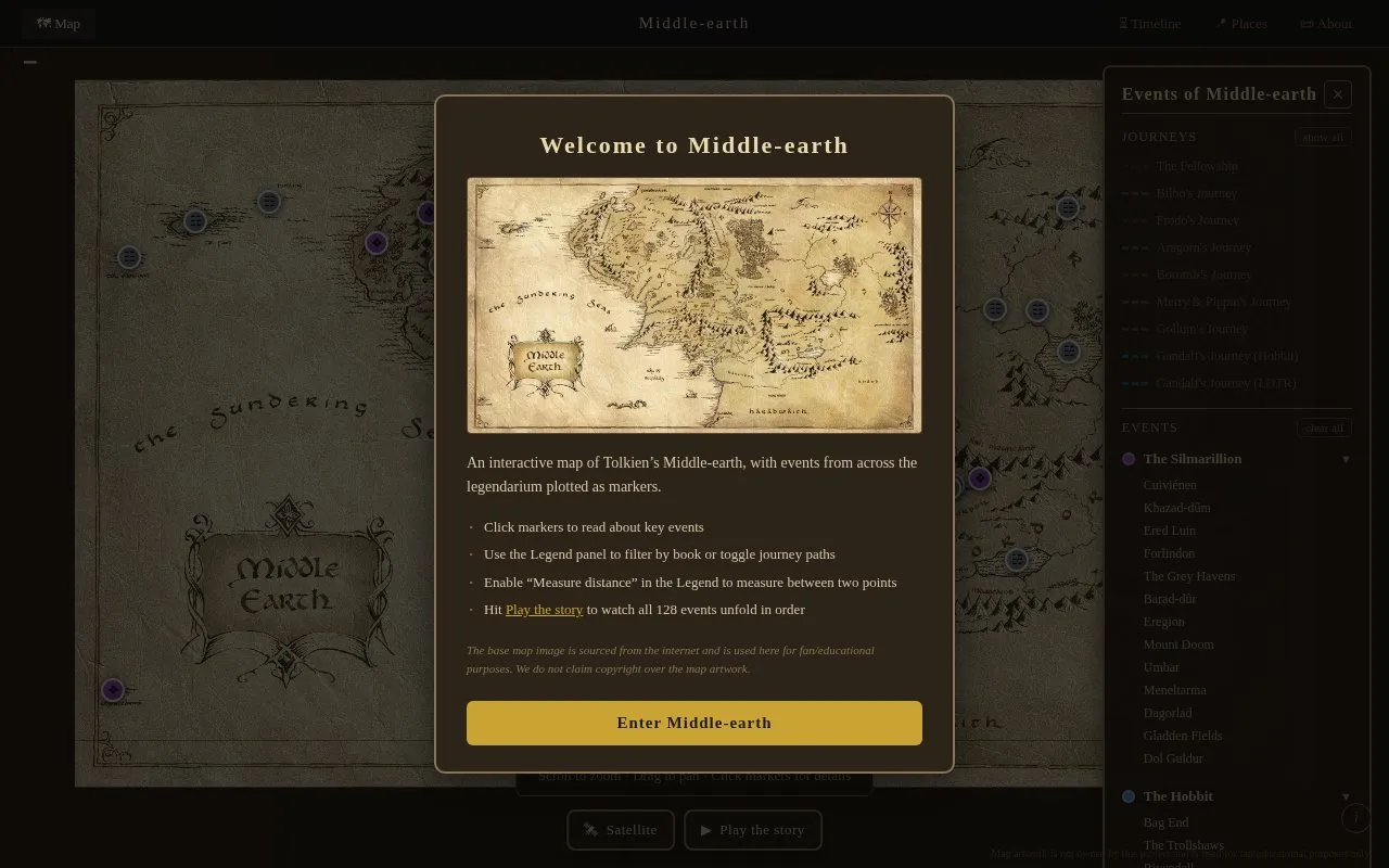
The Middle-earth Map plots events from The Lord of the Rings, The Hobbit and The Silmarillion with paths and a satellite view.
About Middle-Earth Map
The Middle-earth Map is an interactive map of Tolkien's Middle-earth with 128 markers for events from The Lord of the Rings, The Hobbit and The Silmarillion. Users can click markers for details, filter by book, toggle journey paths, use a satellite view, measure distance between two points, and play the events in order.
The base map image is sourced from the internet and is used for fan/educational purposes, with no copyright claim by the project.
Key features
- 128 markers for events from three Tolkien books
- Filter markers by book using Legend panel
- Toggle journey paths on the map
- Satellite view option for the map
- Measure distance between two points
- Play mode shows 128 events in order
Best for: Readers of The Lord of the Rings, The Hobbit, and The Silmarillion who want to locate story events on a map.
Good for
- Covers events from three Tolkien books in one map
- Includes journey paths and satellite view
- Offers ordered playback and distance measurement
Middle-Earth Map at a glance
- Category
- Lifestyle & Hobbies › Fun & Interesting Sites
- Type
- Website
- Pricing
- Not confirmed. Check the site
- Platforms
- Web
- Open source
- Not stated
- Language
- English
- Last checked
- Oct 5, 2026 · Online when checked
- Listed
- Oct 5, 2026
Middle-Earth Map alternatives
Tools and sites you could use instead, ranked by how closely they match.
Popular in Fun & Interesting Sites
Well-known listings from the same topic.
Paint with Musicartsandculture.google.com/experiment/paint-wit…FanVersefanverse.orgGlobalPenFriendsglobalpenfriends.comSpaceBattlesforums.spacebattles.comSheepishPatiosheepishpatio.netMangolink Worldmangolinkworld.com


Middle-Earth Map FAQ
How can I view all events in order?
Hit Play the story to watch all 128 events unfold in order.
How do I measure distance on the map?
Enable "Measure distance" in the Legend to measure between two points.
How do I show only one book or show journey paths?
Use the Legend panel to filter by book or toggle journey paths.
Is something wrong or out of date?
Tell us and an editor will check it.
Own this website?
Claim this listing
Claim the listing and suggest updates yourself. An editor checks every claim first.