

ShippingExplorer shows ships around the world on a live AIS map, with demo data delayed by up to 72 hours.
AIS Ships Map
AIS Ships Map provides satellite AIS ship tracking and historical vessel data, with API plans and account services.
About AIS Ships Map
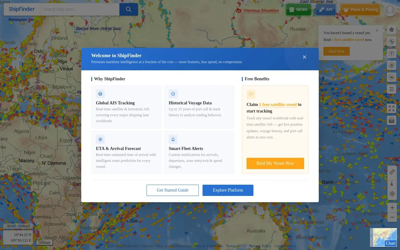
AIS Ships Map (ShipFinder) is a web-based ship tracking platform that uses satellite and terrestrial AIS to show global real-time vessel positions. It provides detailed ship information and worldwide port data for monitoring marine traffic.
You can search for vessels, view live positions, check voyage history and port calls, see estimated time of arrival with route prediction, and set alerts for arrivals, departures, zone entry/exit and speed changes. The site includes account sign-in, a Personal Center, Help Center, API information, and Plans & Pricing. New users can bind one satellite vessel for free to receive position updates, history, and alerts.
It suits anyone who needs to follow commercial shipping or specific vessels, including logistics staff, researchers, and general users interested in marine traffic.
Key features
- Real-time satellite and terrestrial AIS vessel tracking
- Global vessel positions and detailed ship information
- Historical track lookup with port call history
- ETA and arrival forecast with route prediction
- Custom alerts for arrivals, departures and speed changes
- Worldwide port data for marine traffic monitoring
Best for: People who need to monitor vessel positions, voyage history, and port activity worldwide.
Good for
- One free satellite vessel for new users
- Up to 15 years of historical voyage data
- Combines satellite and terrestrial AIS coverage
- API access and account services available
Watch out for
- Free satellite tracking limited to one vessel
AIS Ships Map at a glance
- Website
- shipfinder.com/Monitor/Index
- Category
- Travel & Maps › Flight & Ship Tracking
- Type
- Website
- Pricing
- Freemium
- Platforms
- Web
- Open source
- Not stated
- Language
- English
- Last checked
- Oct 5, 2026 · Online when checked
- Listed
- Oct 5, 2026
AIS Ships Map alternatives
Tools and sites you could use instead, ranked by how closely they match.
MarineTraffic displays live ship positions and information about vessels and maritime activity.
ShipAIS.uk shows live shipping movements from AIS data and a webcam covering the River Mersey and Liverpool Bay.

ADS-B Exchange offers live aircraft tracking APIs and historical aircraft data products.

This article introduces maritime OSINT techniques for gathering information about ships and ocean activity.
Pick
9 alternatives
The Shipping Database is a research project with vessel name, IMO, year, and owner or company fields.
Popular in Flight & Ship Tracking
Well-known listings from the same topic.
Container Trackingcontainer-tracking.orgCrewlist.org.ukcrewlist.org.ukContainer trackingtrack-trace.com/container


AIS Ships Map FAQ
What is ShipFinder?
ShipFinder is a web platform for satellite AIS ship tracking with real-time vessel positions, ship information, and port data.
Is ShipFinder free to use?
You can bind 1 free satellite vessel for live updates, voyage history, and port call alerts. The site also has a Plans & Pricing page for other options.
What historical data does ShipFinder provide?
It provides up to 15 years of port call and track history for reviewing past voyages.
Does ShipFinder offer an API?
Yes, the site lists API information and support for API integration.
Is something wrong or out of date?
Tell us and an editor will check it.
Own this website?
Claim this listing
Claim the listing and suggest updates yourself. An editor checks every claim first.