

Amsterdam’s municipal data site provides current city information and lets visitors search streets, buildings, public spaces, map layers, and datasets.
GeoPortal.rlp
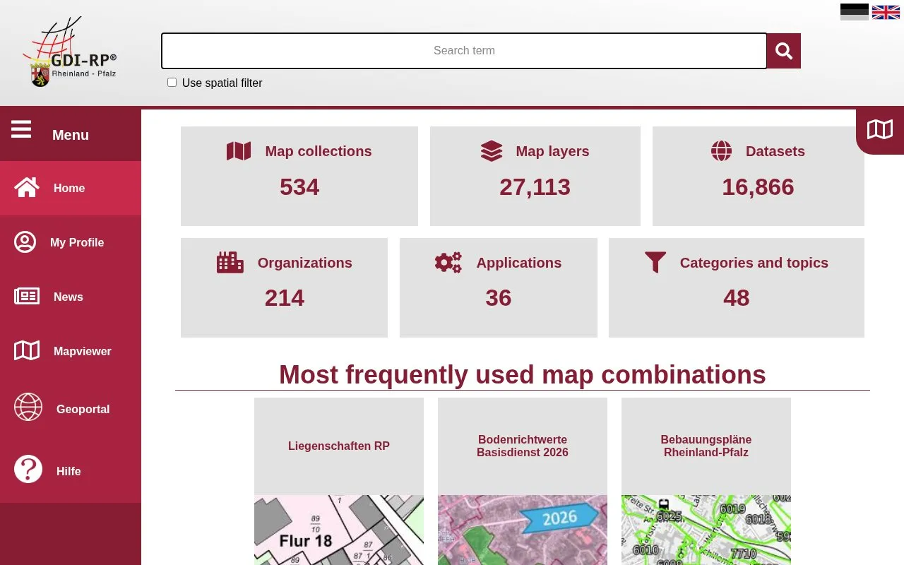
GeoPortal RLP provides map layers, datasets, organizations, applications, and thematic categories for Rhineland-Palatinate.
About GeoPortal.rlp
GeoPortal.rlp is a web portal for geographic data for Rhineland-Palatinate. It provides searchable map collections, map layers, datasets, organizations, applications and thematic categories.
It includes cadastral data from ALKIS, 2026 land reference values, municipal development plans, cultural monuments, historical maps and aerial images, and open-data geodata services from the state surveying and cadastral administration. Content is in German, and the premium 2026 land-value compilation requires paid activation.
Key features
- Search map collections, layers, datasets and organizations
- View ALKIS cadastral layers for buildings, parcels and land use
- Query parcel identifiers, location, official area and actual use
- View 2026 land reference values with aerial imagery and boundaries
- Browse municipal development plans including plans in public display
- Browse cultural monument records, historical maps and aerial images
Best for: People needing Rhineland-Palatinate cadastral, planning, land-value, or historical map information.
Good for
- Centralizes cadastral, planning, land-value, monument and historical geodata for Rhineland-Palatinate
- Offers open-data geodata services from the state surveying and cadastral administration
- Provides contextual layers such as aerial imagery, administrative boundaries and average value levels
Watch out for
- Content is in German
- Premium 2026 land-value compilation requires paid activation
- Cadastral view is not the official property map and designations are informational only
GeoPortal.rlp at a glance
- Website
- geoportal.rlp.de
- Category
- Research & Data › Open Data & Datasets
- Type
- Website
- Pricing
- Not confirmed. Check the site
- Platforms
- Web
- Open source
- Not stated
- Language
- German
- Last checked
- Oct 5, 2026 · Online when checked
- Listed
- Oct 5, 2026
GeoPortal.rlp alternatives
Tools and sites you could use instead, ranked by how closely they match.
The City of Antwerp’s open-data geoportal provides access to municipal datasets and geographic information.

The Estonian Social Science Data Archive provides online data search and analysis, with thematic collections covering social research.

Ukraine's official open data portal lets visitors search datasets, browse publishers, and explore public records across topic categories.
Mexico’s National Open Data Platform presents government datasets, data visualizations, institutions, and categories.

OpenDataPhilly catalogs open datasets from Philadelphia and regional organizations.
Popular in Open Data & Datasets
Well-known listings from the same topic.
data.worlddata.worldNASA APIapi.nasa.govCosmoSimcosmosim.orgState of Hawaiidata.hawaii.govdata.meudon.frdata.meudon.frESS-DIVEess-dive.lbl.gov


GeoPortal.rlp FAQ
What is a Bodenrichtwert?
It is the average location value of soil in EUR per sqm for most plots in a zone with essentially the same use and value conditions.
How can I access the premium 2026 land-value service?
It requires paid activation, which can be requested at https://geoshop.rlp.de/bodenrichtwert-premiumdienst.html.
Does the cultural monument directory include all monuments in Rhineland-Palatinate?
No. It presents the currently recorded stock and states that it does not claim completeness.
Is something wrong or out of date?
Tell us and an editor will check it.
Own this website?
Claim this listing
Claim the listing and suggest updates yourself. An editor checks every claim first.