

Sen provides live 4K video views of Earth captured by its satellites in space.
Planet Globe
Planet presents satellite imagery of Earth, including a visualization of images captured across a single day.
About Planet Globe
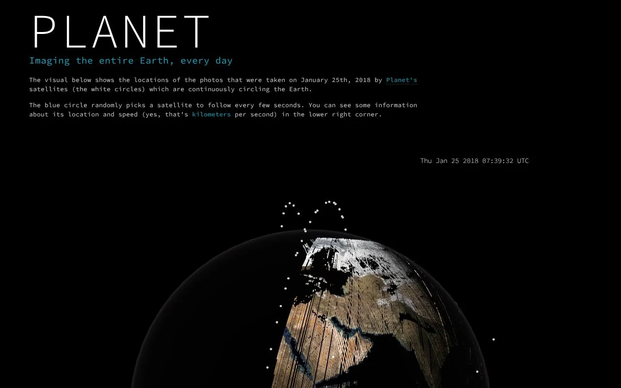
Planet Globe is a web-based visualization tool that displays the geographic locations of satellite images captured by Planet's Earth imaging constellation over a single day. The default view shows 20% of images taken on January 25, 2018, while the desktop version displays 100% of that day's captured image locations.
The tool includes a feature that randomly selects an active satellite to track every few seconds, showing its location and speed in kilometers per second in the lower right corner. Gaps in the visualization may appear due to complete cloud cover over landmasses or periods when satellites are not actively capturing or transmitting data.
Key features
- Shows geographic locations of Planet's single-day satellite imagery
- Default view displays 20% of January 25, 2018 image locations
- Desktop version shows 100% of single-day captured image locations
- Tracks a random active satellite, showing location and speed
- Notes gaps from cloud cover or inactive satellite periods
Best for: It is best for users interested in visualizing the coverage and activity of Planet's Earth imaging satellite constellation.
Good for
- Uses actual satellite imagery location data from Planet's constellation
- Provides both sample 20% and full 100% desktop views of daily captures
- Includes live tracking of an active satellite with speed metrics
Watch out for
- Default view only shows 20% of imagery from a single 2018 date
- Landmass gaps appear due to cloud cover or inactive satellite periods
- Full 100% image location view is limited to desktop versions
Planet Globe at a glance
- Category
- Education & Learning › Space & Astronomy
- Type
- Website
- Pricing
- Not confirmed. Check the site
- Platforms
- Web
- Open source
- Not stated
- Language
- English
- Last checked
- Oct 6, 2026 · Online when checked
- Listed
- Oct 5, 2026
Planet Globe alternatives
Tools and sites you could use instead, ranked by how closely they match.

NASA's Eyes offers browser-based three-dimensional visualizations for exploring NASA data and imagery.

The 100,000 Stars visualization presents nearby stars in 3D and provides controls for color and temperature.

SpaceFromSpace archives declassified Cold War satellite imagery and modern spaceport photographs on interactive maps.

The SLIDER explorer displays satellite imagery from GOES-16 and Himawari-8 with interactive playback and overlays.

SGP4.gl provides a GPU-accelerated three-dimensional satellite visualization using SGP4, CesiumJS, and Next.js.
Popular in Space & Astronomy
Well-known listings from the same topic.
Imagesimages.nasa.govNASAnasa.govHistorynasa.gov/historyFirstMenOnTheMoonfirstmenonthemoon.comVisible Earthvisibleearth.nasa.govJPL Photojournalphotojournal.jpl.nasa.gov


Planet Globe FAQ
What date does the satellite imagery location data cover?
The default visualization shows locations of images captured on January 25, 2018.
Why are some landmasses missing from the visualization?
Gaps occur due to complete cloud cover or periods when satellites are not capturing or transmitting data.
What information is displayed for the tracked satellite?
The tracked satellite's location and speed in kilometers per second are shown in the lower right corner.
Is something wrong or out of date?
Tell us and an editor will check it.
Own this website?
Claim this listing
Claim the listing and suggest updates yourself. An editor checks every claim first.