Generate a panorama
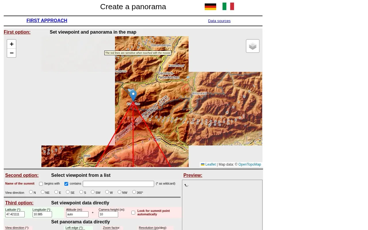
Generate an alpine panorama by choosing a viewpoint on the map; the tool can identify visible mountain summits.
About Generate a panorama
Generate a panorama creates a rendered mountain panorama from a user-chosen viewpoint and labels visible summits. Users can pick the viewpoint by clicking a map, selecting from a list, or entering latitude, longitude and altitude, then set view direction, edges, and parameters such as range of sight, tilt and elevation exaggeration.
Coverage extends to the whole earth, with summit naming most dense in the Alps and Pyrenees and GeoNames data used elsewhere. On-screen panoramas are limited to 14400 pixels in width, email delivery can take one to two hours, and JavaScript must be permitted.
Key features
- Choose viewpoint by map click, list, or coordinates
- Set view direction and panorama edges on map
- Adjust range of sight, tilt, and elevation exaggeration
- Identify and label visible mountain summits
- Request panorama delivery by email link
- Search summit list by name with wildcard
- Covers the whole earth for panorama generation
- Offers three ways to define the viewpoint
- Allows email delivery without the on-screen width limit
- On-screen panoramas limited to 14400 pixels in width
- Emailed panorama links can take one to two hours
- Commercial use requires written consent
Generate a panorama at a glance
- Category
- Travel & Maps › Maps, Navigation & Weather
- Type
- Website
- Pricing
- Not confirmed. Check the site
- Platforms
- Web
- Open source
- Not stated
- Last checked
- Oct 5, 2026 · Online when checked
- Listed
- Oct 5, 2026
Popular in Maps, Navigation & Weather
Well-known listings from the same topic.


Generate a panorama FAQ
How do I create a panorama?
How long does delivery by email take?
Can I use the panoramas commercially?
Tell us and an editor will check it.
Claim the listing and suggest updates yourself. An editor checks every claim first.