

Prague’s geoportal provides geographic data and maps, including map applications, open data, map services, and planning resources.
Geoportal of the South Moravian Region
The South Moravian Region geoportal provides map applications and regional geographic information.
About Geoportal of the South Moravian Region
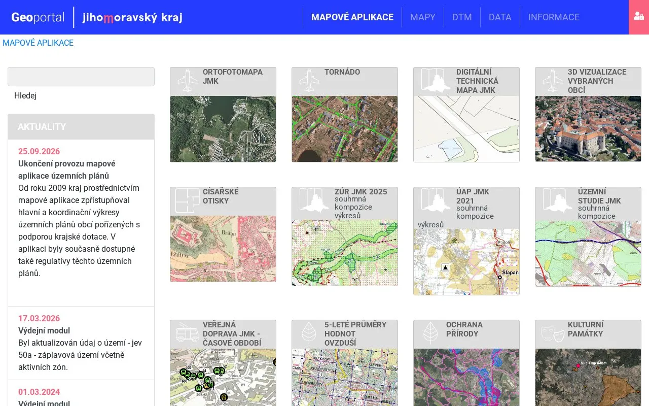
The Geoportal of the South Moravian Region is a set of map applications that presents regional geographic information for the Jihomoravský kraj (South Moravian Region) in the Czech Republic. It brings together aerial photographs, air quality maps, nature protection and cultural heritage layers, and spatial planning documents in one place. The homepage lists a notice that the spatial plans map application will be discontinued on 25.09.2026.
The portal includes a historical orthophoto collection starting in 1953, a public transport viewer based on vehicle GPS positions, and a 3D viewer for selected municipalities. Some data is updated on a schedule: for example, the flood zone layer was updated in March 2026. The homepage text is in Czech, and the public transport application supports only specific browsers. The source does not state any pricing terms.
Key features
- Time series of regional orthophoto maps from 1953 onward
- Public transport vehicle positions over time, based on GPS data collected every 10 seconds
- Five-year average air pollutant maps on a 1 km grid
- Layers for protected areas, Natura 2000 sites, and flood zones
- Locations of cultural monuments, heritage zones, and archaeological reserves
- 3D visualizations of selected municipalities with adjustable lighting and effects
Best for: Residents, planners, and researchers who need regional maps and geographic data for the South Moravian Region and can read Czech.
Good for
- Combines several regional datasets, including imagery, environmental layers, and heritage locations, in one portal
- Includes historical aerial imagery going back to 1953
- Recent update notices show that some layers, such as flood zones, are maintained
Watch out for
- The homepage and notices are in Czech
- The public transport application supports only Google Chrome, Microsoft Edge, and Mozilla Firefox, and does not support Internet Explorer
- The 3D visualization does not support Internet Explorer or Opera, and the spatial plans map application is scheduled for discontinuation
Geoportal of the South Moravian Region at a glance
- Website
- mapy.jmk.cz/geoportal
- Category
- Research & Data › Open Data & Datasets
- Type
- Website
- Pricing
- Not confirmed. Check the site
- Platforms
- Web
- Open source
- Not stated
- Last checked
- Oct 6, 2026 · Online when checked
- Listed
- Oct 5, 2026
Geoportal of the South Moravian Region alternatives
Tools and sites you could use instead, ranked by how closely they match.
The City of Antwerp’s open-data geoportal provides access to municipal datasets and geographic information.

DataSud is shared data infrastructure for the Provence-Alpes-Cote d'Azur region, with open data discovery and regional themes.

Region Västmanland makes open information available for reuse, including supplier invoices and regional indicators.
Free
24 alternatives
The GeoPortal.MV platform helps users view maps and find places, topics, geodata, and metadata for Mecklenburg-Vorpommern.

GeoPortal RLP provides map layers, datasets, organizations, applications, and thematic categories for Rhineland-Palatinate.
Popular in Open Data & Datasets
Well-known listings from the same topic.
data.worlddata.worldNASA APIapi.nasa.govCosmoSimcosmosim.orgdata.meudon.frdata.meudon.frESS-DIVEess-dive.lbl.govState of Hawaiidata.hawaii.gov


Geoportal of the South Moravian Region FAQ
Is the spatial plans map application still available?
The homepage notice dated 25.09.2026 states that the map application for spatial plans is being discontinued.
How often is public transport position data collected?
The public transport application shows vehicle positions based on GPS data that is collected at 10-second intervals.
How are the five-year air quality averages calculated?
The maps cover a 1 km grid and are calculated in GIS from area maps for individual years, not from averages of station readings over five years.
Is something wrong or out of date?
Tell us and an editor will check it.
Own this website?
Claim this listing
Claim the listing and suggest updates yourself. An editor checks every claim first.