

Sen provides live 4K video views of Earth captured by its satellites in space.
Space Atlas
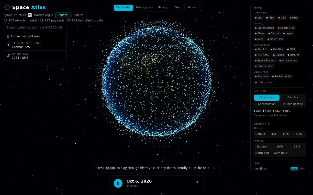
Space Atlas tracks satellites and rocket bodies on a live 3D map, with history extending from Sputnik to today.
About Space Atlas
Space Atlas is an interactive 3D map that shows tracked satellites and rocket bodies orbiting Earth in real time. It includes a timeline from 1957 to the present for reviewing past launches and positions, and can show which satellites are passing over the user's location.
Users can filter by orbit class, country, constellation, and object type, and adjust layers such as orbit paths and launch trails. Orbital positions are approximated from the public CelesTrak catalog.
Key features
- Live 3D map of tracked satellites and rocket bodies
- Timeline scrub from 1957 to present with monthly and hourly controls
- Show satellites passing over user's own location
- Filter by orbit class, country, constellation, and object type
- Color map points by orbit class, country, constellation, or decade
- Toggle orbit paths, launch trails, stars, and day-night display
Best for: People who want to view current satellite positions and explore orbital history since 1957.
Good for
- Covers tracked objects from 1957 to the present
- Shows real-time positions and overhead passes for user location
- Filtering by orbit class, country, constellation, and object type
Watch out for
- Orbital positions are approximated from public catalog data
Space Atlas at a glance
- Website
- spaceatlas.tech
- Category
- Education & Learning › Space & Astronomy
- Type
- Website
- Pricing
- Not confirmed. Check the site
- Platforms
- Web
- Open source
- Not stated
- Language
- English
- Last checked
- Oct 5, 2026 · Online when checked
- Listed
- Oct 5, 2026
Space Atlas alternatives
Tools and sites you could use instead, ranked by how closely they match.

ISS Tracker shows the location of the International Space Station and other satellites on a live map.

The ISS in Real Time page is titled as a live International Space Station tracking resource.

Find Starlink helps users calculate when Starlink satellites can be seen overhead, with a live map.

Satellite Map tracks satellites in real time on an interactive 3D map.

KeepTrack tracks more than 37,000 satellites in real time and provides user profiles and achievements.
Popular in Space & Astronomy
Well-known listings from the same topic.
Imagesimages.nasa.govNASAnasa.govHistorynasa.gov/historyFirstMenOnTheMoonfirstmenonthemoon.comVisible Earthvisibleearth.nasa.govJPL Photojournalphotojournal.jpl.nasa.gov


Is something wrong or out of date?
Tell us and an editor will check it.
Own this website?
Claim this listing
Claim the listing and suggest updates yourself. An editor checks every claim first.