

GeoSeer searches for spatial web services and GIS datasets, including WMS, WFS, WCS, and WMTS.
CoMaps
CoMaps supports offline search, routing, and trip planning for hiking, biking, and driving using GPS.
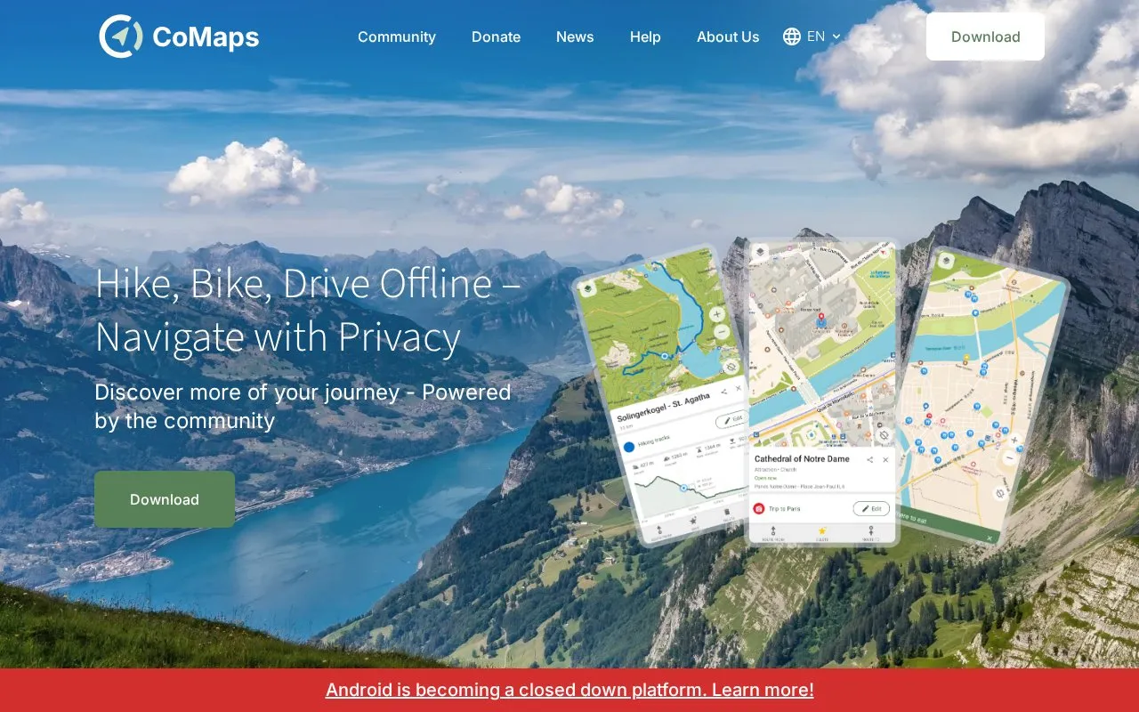
About CoMaps
CoMaps provides offline search, routing, and trip planning for hiking, biking, and driving using GPS without mobile data. It includes turn-by-turn instructions with voice announcements, outdoor details such as trails, campsites, water sources and contour lines, offline Wikipedia articles, and a public transport layer for subway and light rail in a growing list of cities.
The project describes itself as community-built and a fork of Organic Maps and Maps.Me, with contributions through OpenStreetMap and Codeberg. It states that it does not identify people, track them, or collect information, and notes an audit by Exodus.
Key features
- Offline search and routing using GPS without mobile data
- Turn-by-turn navigation by foot, bike, or car with voice announcements
- Outdoor mode highlighting hiking trails, campsites, water sources
- Contour lines for trip planning
- Offline Wikipedia articles for places
- Public transport layer for subway and light rail journeys
Best for: People who hike, bike, or drive in areas with limited mobile data and need offline navigation.
Good for
- Functions with GPS without mobile data
- States no identification, tracking, or data collection, with audit by Exodus
- Covers hiking, biking, driving, and public transport in one place
Watch out for
- Public transport information is limited to a growing list of cities
CoMaps at a glance
- Website
- comaps.app
- Category
- Travel & Maps › Maps, Navigation & Weather
- Type
- Website
- Pricing
- Not confirmed. Check the site
- Platforms
- Web
- Open source
- Not stated
- Language
- English
- Last checked
- Oct 5, 2026 · Online when checked
- Listed
- Oct 5, 2026
CoMaps alternatives
Tools and sites you could use instead, ranked by how closely they match.

Organic Maps offers free offline maps and GPS navigation as an open-source mobile app.

Organic Maps is a free offline mapping app for Android and iOS using community-sourced OpenStreetMap data.
Free
24 alternatives
An Android app provides de-Googled maps and turn-by-turn navigation using MapLibre and Overture points of interest.
Open source
16 alternatives
CalTopo provides topographic maps and tools for collaborative trip planning, elevation profiles, terrain analysis, and printing.

Bing Maps offers multi-stop route planning, transit, walking and driving directions, traffic, and satellite and 3D imagery.
Popular in Maps, Navigation & Weather
Well-known listings from the same topic.
OpenWeatherMapopenweathermap.org511on.ca511on.caFIRMSfirms.modaps.eosdis.nasa.gov/mapWeather History & Data Archivewunderground.com/historyORBISorbis.stanford.eduEarth Engine Datasetdevelopers.google.com/earth-engine/datasets


CoMaps FAQ
Does CoMaps work without mobile data?
Yes, it plans and navigates with GPS without mobile data, including offline search and routing.
Which travel modes have turn-by-turn navigation?
Foot, bike, and car, with voice announcements.
Does CoMaps collect user data?
According to the site, it does not identify people, track them, or collect information, and it was audited by Exodus.
Is something wrong or out of date?
Tell us and an editor will check it.
Own this website?
Claim this listing
Claim the listing and suggest updates yourself. An editor checks every claim first.