

The Iowa Data Hub provides access to data collected, created, and maintained by Iowa state agencies.
VectorSurv
VectorSurv helps public health agencies manage, analyze, and visualize vector-borne disease surveillance data.
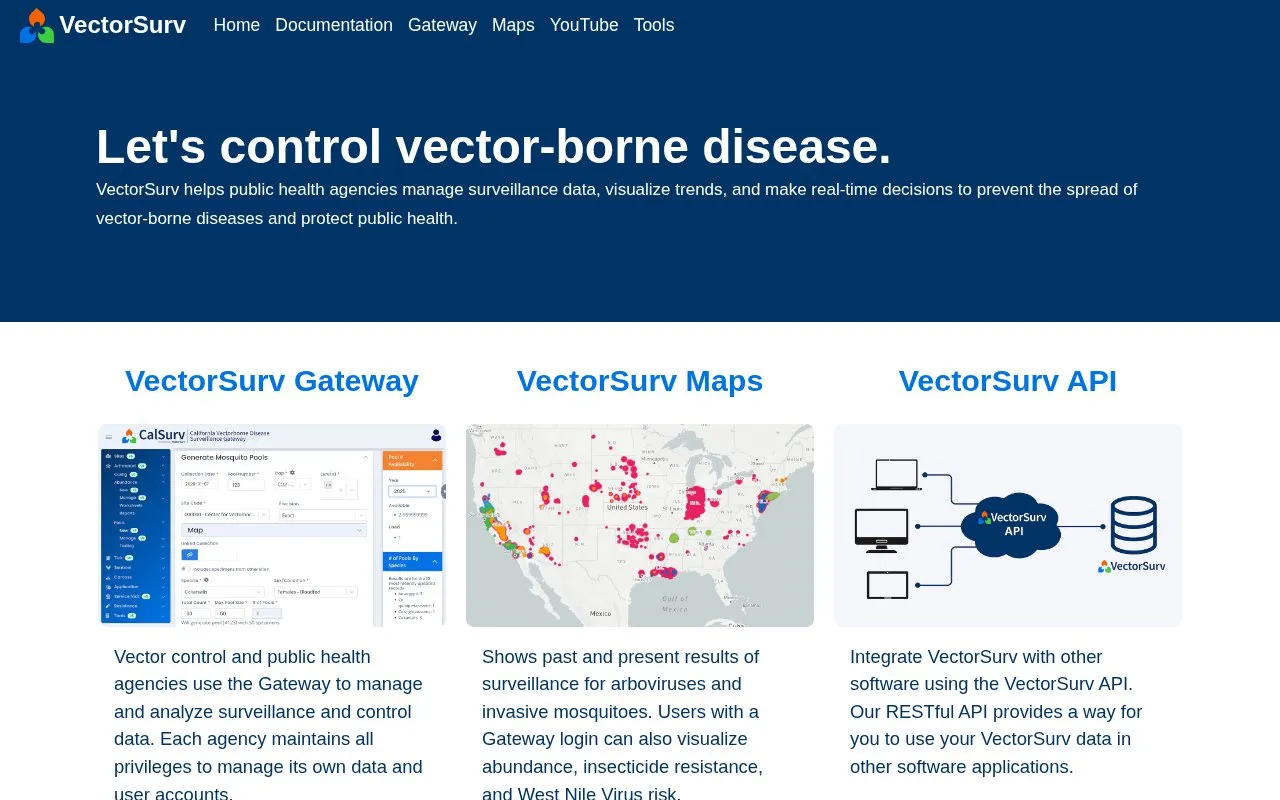
About VectorSurv
VectorSurv is a web-based surveillance system for vector-borne disease data. It is used by public health and vector control agencies in 36 states and territories, including more than 390 agencies and 1,300 users. The system was first launched in 2006 and works with state and local agencies and the U.S. Centers for Disease Control and Prevention, Division of Vector-Borne Diseases, including reporting to ArboNet.
Agencies use the VectorSurv Gateway to manage and analyze surveillance and control data, with each agency controlling its own data and user accounts. VectorSurv Maps shows past and present surveillance results for arboviruses and invasive mosquitoes. Users with a Gateway login can also view abundance, insecticide resistance, and West Nile virus risk. A RESTful API allows VectorSurv data to be used in other software applications.
The system suits state and local health departments, mosquito and vector control districts, and public health staff involved in surveillance. Public map pages provide general surveillance information, while data management and detailed views require a Gateway login.
Key features
- Gateway to manage and analyze surveillance and control data
- Agency-controlled data access and user account management
- Maps of arbovirus and invasive mosquito surveillance results
- Visualize abundance, insecticide resistance, West Nile virus risk for Gateway users
- RESTful API to use VectorSurv data in other software
- Reporting support for ArboNet
Best for: Public health and vector control agencies managing mosquito and arbovirus surveillance data benefit most.
Good for
- Used by 390+ agencies across 36 states and territories
- Each agency retains control of its own data
- Combines data management, maps, and API in one system
- Works with CDC Division of Vector-Borne Diseases
Watch out for
- Full map details and data management require a Gateway login
VectorSurv at a glance
- Website
- vectorsurv.org
- Category
- Research & Data › Climate & Environmental Data
- Type
- Website
- Pricing
- Not confirmed. Check the site
- Platforms
- Web
- Open source
- Not stated
- Language
- English
- Last checked
- Oct 5, 2026 · Online when checked
- Listed
- Oct 5, 2026
VectorSurv alternatives
Tools and sites you could use instead, ranked by how closely they match.

OCTOPUS lets users visualize, query, and download data on radionuclide and luminescence dating, denudation rates, and related records.

GFBio supports research data management for biodiversity, ecology, and environmental studies, with services to plan, submit, and visualize data.

Statistics Canada's data catalog offers searchable tables, microdata, and visualizations across topics including health, labor, and trade.
The Sierra Leone Data Portal provides a catalog of datasets organized by topics such as agriculture, health, energy, and trade.

HydroShare lets users find, analyze, share, and collaborate on water data and research resources.
Popular in Climate & Environmental Data
Well-known listings from the same topic.
IOOS®ioos.noaa.govClouds and the Earth's Radiant Energy Systemceres.larc.nasa.govPAINTpaint-database.orgSIBiLSsibils.orgNatureServenatureserve.orgMountain Scholarmountainscholar.org


VectorSurv FAQ
What is VectorSurv?
VectorSurv is a web-based system that helps public health agencies manage, analyze, and visualize vector-borne disease surveillance data.
Who can use the VectorSurv Gateway?
Vector control and public health agencies use the Gateway to manage surveillance and control data, with each agency managing its own data and user accounts.
What does VectorSurv Maps show?
Maps show past and present surveillance results for arboviruses and invasive mosquitoes. Gateway users can also view abundance, insecticide resistance, and West Nile virus risk.
Does VectorSurv offer an API?
Yes, VectorSurv provides a RESTful API that allows VectorSurv data to be used in other software applications.
Is something wrong or out of date?
Tell us and an editor will check it.
Own this website?
Claim this listing
Claim the listing and suggest updates yourself. An editor checks every claim first.