
EarthEnv develops standardized global environmental layers for studying biodiversity, ecosystems, and climate.
Geoportal of the Grand-Duchy of Luxembourg
Luxembourg’s geoportal includes public map layers and a 3D viewer with tools for interacting with 3D data.
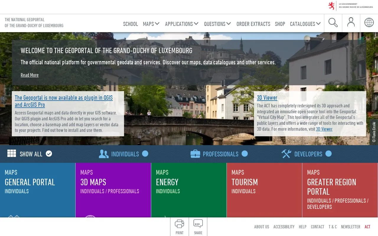
About Geoportal of the Grand-Duchy of Luxembourg
The Geoportal of the Grand-Duchy of Luxembourg provides map viewers for Luxembourg covering cadastre, topography, infrastructure, environment, water, land use plans and other topics. It includes a 3D viewer that integrates public layers with tools for interacting with 3D data, and QGIS and ArcGIS Pro plugins to search locations, select a basemap and add layers or vector data in desktop GIS software.
Additional applications include an address index, route planner for the greater region, distance calculator, coordinate conversion from WGS84 to LUREF, STL export for 3D printing zones up to 500x500m, and a Map API. Some portals, including the professional portal and the surveyors portal, are limited to authorised users or require login.
Key features
- 3D viewer with public layers and tools for interacting with 3D data
- QGIS and ArcGIS Pro plugins to add basemaps and layers
- Thematic maps for cadastre, water, environment and land use
- STL export for 3D printing zones up to 500x500m
- Route planner for car routes in the greater region
- Address index covering Luxembourg street addresses
Best for: People who need Luxembourg geographic, cadastral, environmental and planning maps and 3D data.
Good for
- Multiple thematic maps for cadastre, environment, water and land use in one site
- Desktop GIS access through QGIS plugin and ArcGIS Pro add-in
- Practical utilities such as address index, route planner and coordinate converter
Watch out for
- Professional portal limited to authorised users
- Surveyors portal requires login
- 3D print STL export limited to 500x500m zones in Luxembourg
Geoportal of the Grand-Duchy of Luxembourg at a glance
- Website
- geoportail.lu/en
- Category
- Research & Data › Climate & Environmental Data
- Type
- Website
- Pricing
- Not confirmed. Check the site
- Platforms
- Web
- Open source
- Not stated
- Language
- English
- Last checked
- Oct 5, 2026 · Online when checked
- Listed
- Oct 5, 2026
Geoportal of the Grand-Duchy of Luxembourg alternatives
Tools and sites you could use instead, ranked by how closely they match.

Remote Sensing Systems provides public data files available over ftp with account registration, plus documentation on downloads and file versions and announcements on data releases and discontinuations.

VectorSurv helps public health agencies manage, analyze, and visualize vector-borne disease surveillance data.
The Croydon Observatory shares data and information about the borough through mapping and reporting tools for public use.

Bhoonidhi provides access to an archive of remote-sensing data from Indian satellites.

The Atlantic Canada Conservation Data Centre provides biodiversity information for the region.
Popular in Climate & Environmental Data
Well-known listings from the same topic.
IOOS®ioos.noaa.govClouds and the Earth's Radiant Energy Systemceres.larc.nasa.govOCTOPUS databaseoctopusdata.orgPAINTpaint-database.orgSIBiLSsibils.orgNatureServenatureserve.org


Geoportal of the Grand-Duchy of Luxembourg FAQ
What do the QGIS and ArcGIS Pro plugins do?
They let you search for a location, choose a basemap, and add map layers or vector data to your projects.
What does the 3D viewer cover?
It integrates all of the Geoportal's public layers and provides tools for interacting with 3D data.
What is the size limit for 3D print exports?
STL files are available for zones of up to 500x500m in Luxembourg.
Is something wrong or out of date?
Tell us and an editor will check it.
Own this website?
Claim this listing
Claim the listing and suggest updates yourself. An editor checks every claim first.