

GPS Visualizer creates customized maps from GPS data and offers several output formats.
Ancient Earth
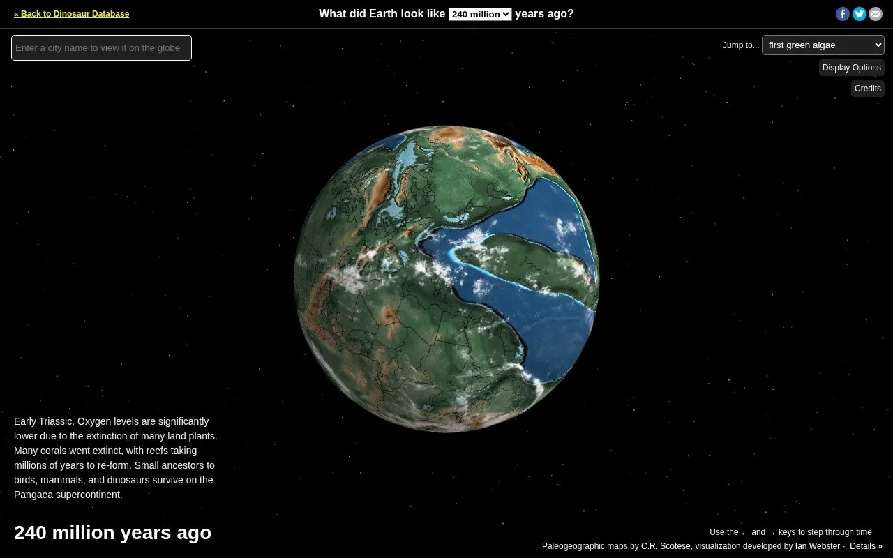
Ancient Earth lets users search locations across a globe showing how Earth changed over 750 million years.
About Ancient Earth
Ancient Earth is a web-based globe that presents paleogeographic maps showing Earth from 750 million years ago to the present. Users can search for a location or address, move through time, and jump to milestones such as the first land plants, first dinosaurs, or the dinosaur extinction, as well as supercontinents and periods including Pannotia, Pangea, the Triassic, Jurassic, and Cretaceous.
The maps are by C.R. Scotese of the PALEOMAP Project, and the visualization is maintained by Ian Webster. Locations are accurate to about 100 km, and some elements, including cloud and star positions, are not adjusted for time.
Key features
- Search for an address or location on a paleogeographic globe.
- Step through time from 750 million years ago to present.
- Jump to events such as first land plants or dinosaur extinction.
- Jump to supercontinents and periods including Pannotia, Pangea, Triassic, Jurassic and Cretaceous.
- Toggle display options for globe rotation, clouds, equator and bright lighting.
- Use left and right arrow keys to step through time.
Best for: Students, educators, and general users interested in paleogeography, Earth history, or seeing where a modern location was in the past.
Good for
- Spans 750 million years with a time control and keyboard shortcuts.
- Provides quick jumps to major biological, geological, and period milestones.
- Includes display options for globe rotation, clouds, equator, and bright lighting.
Watch out for
- Locations are accurate to approximately 100 km.
- Cloud and star positions are not adjusted for time.
Ancient Earth at a glance
- Category
- Travel & Maps › Maps, Navigation & Weather
- Type
- Website
- Pricing
- Not confirmed. Check the site
- Platforms
- Web
- Open source
- Not stated
- Last checked
- Oct 5, 2026 · Online when checked
- Listed
- Oct 5, 2026
Ancient Earth alternatives
Tools and sites you could use instead, ranked by how closely they match.

Globe of History maps battles, inventions, and philosophers across 6,000 years of history.

NASA Global Maps show how key parts of Earth’s climate system change from month to month.
London's Tree Map lets visitors explore more than 1.1 million public trees by species, location, and climate suitability.
Popular in Maps, Navigation & Weather
Well-known listings from the same topic.
OpenWeatherMapopenweathermap.org511on.ca511on.caFIRMSfirms.modaps.eosdis.nasa.gov/mapWeather History & Data Archivewunderground.com/historyORBISorbis.stanford.eduEarth Engine Datasetdevelopers.google.com/earth-engine/datasets


Ancient Earth FAQ
Can I search for a specific address?
The Ancient Earth homepage meta description states that users can search for addresses across 750 million years of Earth.
How accurate are the locations shown?
Locations are accurate to approximately 100 km.
Are all elements on the globe adjusted for time?
No. Cloud and star positions are not adjusted for time.
Is something wrong or out of date?
Tell us and an editor will check it.
Own this website?
Claim this listing
Claim the listing and suggest updates yourself. An editor checks every claim first.