

Mini Macau visualizes Macau transit and aviation in 3D, using schedules to simulate rail, buses, ferries, and airport flights.
Open source
17 alternativesMini Map Macau visualizes transit schedules and city layers, with simulated vehicle positions and separately updated parking availability.
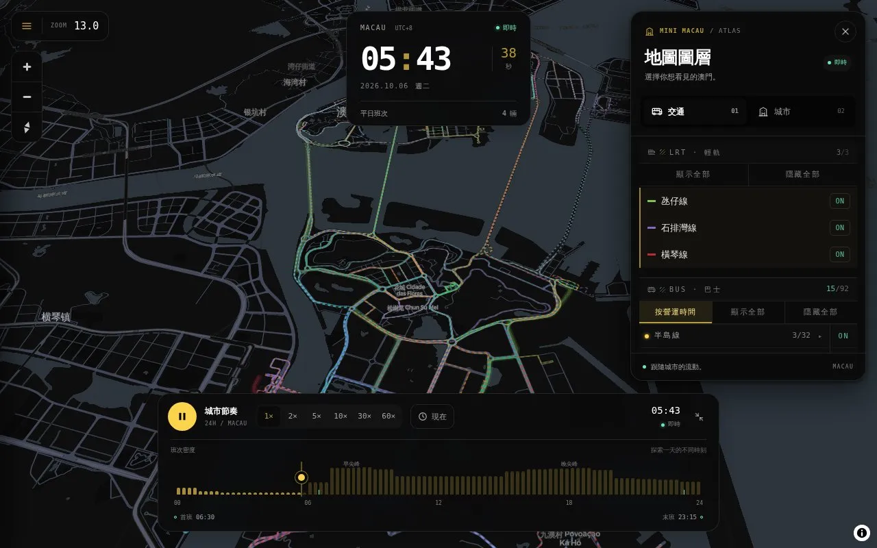
Mini Map Macau is a web-based interactive map of Macau transport and city information. It shows three light rail lines, the bus network, Macau airport flights, and ferries to Hong Kong and Shenzhen, alongside city layers such as parishes, schools, public housing, public toilets, car parks, utilities, and the Grand Prix circuit.
You can switch layers by route or category, select stations for departures, and select vehicles to follow them with simulated speed and next-stop countdowns. You can pause, play at 1x–60x speed, drag the time bar, or pick a date and time in Macau UTC+8, and return to the present with Now. Settings allow 2D or 3D views, light and dark themes, Traditional Chinese, English and Portuguese, and 90%–150% text size.
Vehicle positions, speeds and arrival times are calculated from timetables and headways, not live GPS, while car-park vacancies update separately from DSAT when the layer is on and the clock is set to now. It suits residents, visitors and others who want to explore Macau routes, schedules and city facilities in a browser without installing an app.
Tools and sites you could use instead, ranked by how closely they match.
Mini Macau visualizes Macau transit and aviation in 3D, using schedules to simulate rail, buses, ferries, and airport flights.
TRAVIC visualizes transit vehicle movements using data published by transport agencies, mostly from schedules.
Hong Kong Transit 3D simulates train schedules in a real-time three-dimensional map.
Citymapper provides city transit directions and app information for mobile users.
Well-known listings from the same topic.
Tell us and an editor will check it.
Claim the listing and suggest updates yourself. An editor checks every claim first.


