

Mini Map Macau visualizes transit schedules and city layers, with simulated vehicle positions and separately updated parking availability.
Travic
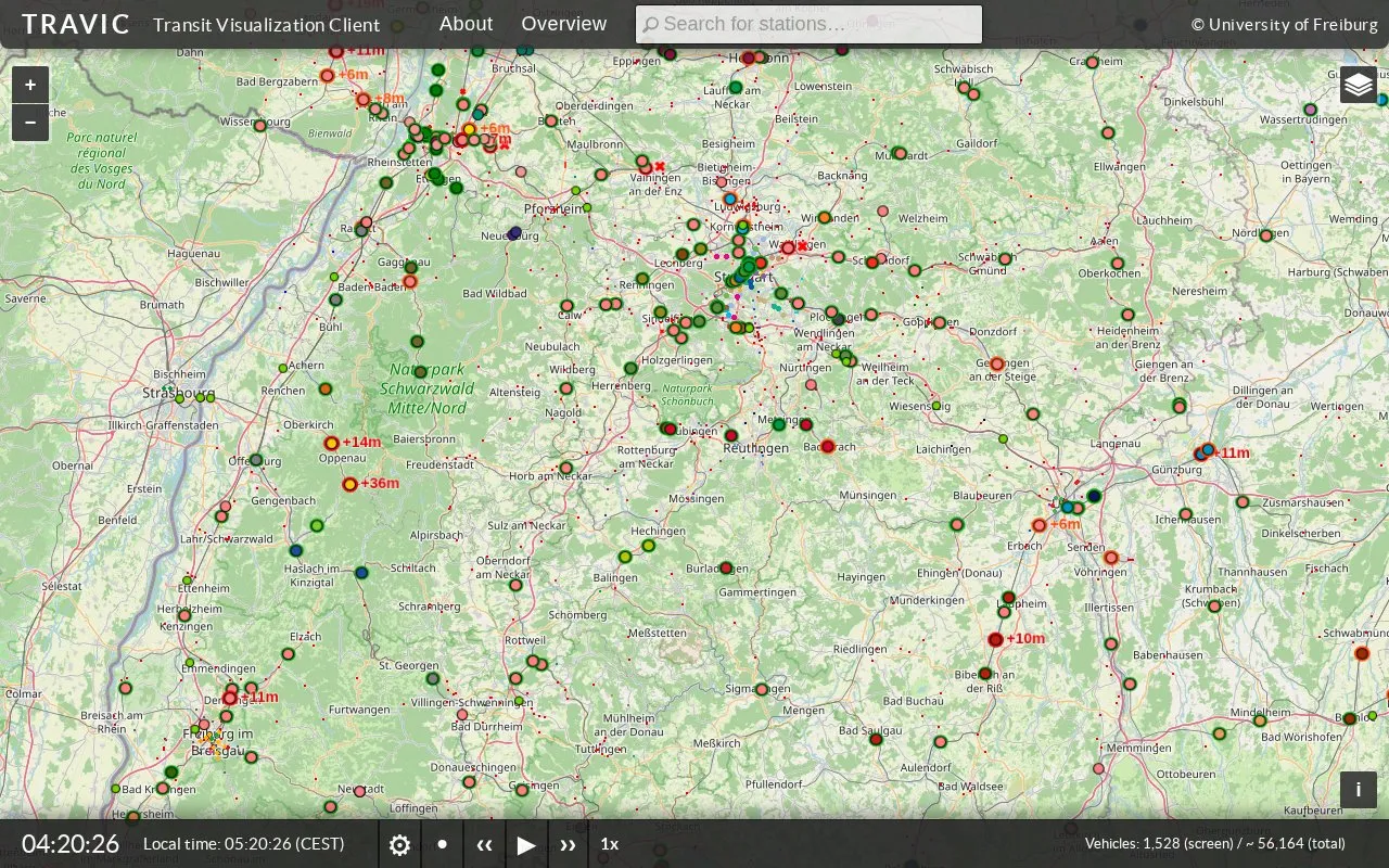
TRAVIC visualizes transit vehicle movements using data published by transport agencies, mostly from schedules.
About Travic
TRAVIC visualizes transit vehicle movements using data published by transit agencies and operators from around the world. Movements are mostly based on static schedule data, with real-time data included where available. Users can open the Overview to see available feeds, select a feed marker to zoom in, and click a vehicle to find links to the publisher's website or license terms.
Data use is subject to the individual publishers' terms, and correctness and completeness of the data are not guaranteed. The service may be modified or discontinued at any time.
Key features
- Visualizes transit vehicle movements from agency-published data
- Uses static schedule data for most movements
- Includes real-time data where available
- Lists available feeds in an Overview view
- Zooms to feed markers to show vehicles
- Links vehicles to publisher sites and license terms
Best for: People who want to view transit vehicle movements based on published schedules and available real-time data.
Good for
- Covers transit agencies and operators from around the world
- Adds real-time information when agencies provide it
- Links each vehicle to its data publisher and license terms
Watch out for
- Most movements reflect static schedules rather than live positions
- Does not guarantee correctness or completeness of data
- Service may be modified or discontinued at any time
Travic at a glance
- Website
- travic.app
- Category
- Travel & Maps › Maps, Navigation & Weather
- Type
- Website
- Pricing
- Not confirmed. Check the site
- Platforms
- Web
- Open source
- Not stated
- Language
- English
- Last checked
- Oct 5, 2026 · Online when checked
- Listed
- Oct 5, 2026
Travic alternatives
Tools and sites you could use instead, ranked by how closely they match.

A real-time three-dimensional map visualizes Tokyo’s public transport system and its movement.
Open source
24 alternatives
WikiRoutes maps urban public transport and provides schedules, route search, and line distances.

Mini Macau visualizes Macau transit and aviation in 3D, using schedules to simulate rail, buses, ferries, and airport flights.
Open source
17 alternatives
Hong Kong Transit 3D simulates train schedules in a real-time three-dimensional map.

The AP Transit map shows MTA subway movements in real time and offers route and station controls.
Popular in Maps, Navigation & Weather
Well-known listings from the same topic.
OpenWeatherMapopenweathermap.org511on.ca511on.caFIRMSfirms.modaps.eosdis.nasa.gov/mapWeather History & Data Archivewunderground.com/historyORBISorbis.stanford.eduEarth Engine Datasetdevelopers.google.com/earth-engine/datasets


Travic FAQ
How do I find vehicles for an area?
Click Overview, click a feed marker to zoom into it, and zoom in further if vehicles are not visible.
Where does TRAVIC get its movement data?
From data published by transit agencies and operators, mostly static schedule data with real-time data where available.
What terms apply to the data shown?
The terms of the publishing agency or operator; click a vehicle to find links to the publisher site or license terms.
Is something wrong or out of date?
Tell us and an editor will check it.
Own this website?
Claim this listing
Claim the listing and suggest updates yourself. An editor checks every claim first.