
CalTopo provides topographic maps and tools for collaborative trip planning, elevation profiles, terrain analysis, and printing.
Oilslick
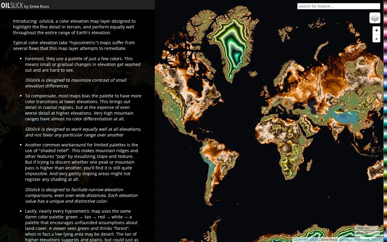
The Oilslick color elevation layer is designed to highlight fine terrain detail on a map.
About Oilslick
Oilslick is a color elevation map layer by Drew Roos. It colors terrain by elevation and is designed to show fine detail across the full range of Earth's elevations, from the Dead Sea to Mount Everest. The author says it is meant to avoid the limits of common hypsometric palettes, which lose detail at high elevations and can suggest land cover that is not there. Each elevation value gets its own color, which is intended to make narrow elevation comparisons easier over wide areas.
The palette uses lightness cycles of 500 m, a hue that completes one rainbow cycle over the land elevation range, and a saturation shift to distinguish rising from falling elevation. The author notes that the Munsell reference data used to build the palette dates from the 1930s and uses illumination standards that are now obsolete. The author also says the hue still does not look fully uniform to them. The source does not describe how to use the layer or what software it works with.
Key features
- Assigns a distinct color to each elevation value in the terrain
- Lightness changes in a repeating cycle every 500 m of elevation
- Hue completes one full rainbow cycle across Earth's land elevation range
- Saturation indicates whether elevation is rising or falling within each cycle
- Orange and blue hues at sea level mark coastlines
- Palette is based on the Munsell color system for perceptual uniformity
Best for: Map readers who need to compare small elevation differences across terrain, especially at high elevations where many palettes show little color variation.
Good for
- Designed to perform equally well across all elevations rather than favoring low-lying coastal areas
- Avoids the common green-tan-red-white palette that can suggest false land-cover assumptions
- Designed to support narrow elevation comparisons over wide distances
Watch out for
- The author says the hue does not appear entirely perceptually uniform, with transitions from purple through green feeling more abrupt
- The only public Munsell sample dataset was collected in the 1930s using obsolete illumination standards
Oilslick at a glance
- Website
- mrgris.com/projects/oilslick
- Category
- Travel & Maps › Maps, Navigation & Weather
- Type
- Website
- Pricing
- Not confirmed. Check the site
- Platforms
- Web
- Open source
- Not stated
- Language
- English
- Last checked
- Oct 6, 2026 · Online when checked
- Listed
- Oct 5, 2026
Oilslick alternatives
Tools and sites you could use instead, ranked by how closely they match.

Topographic Map provides free maps for viewing terrain, elevation, and topography.
Popular in Maps, Navigation & Weather
Well-known listings from the same topic.
OpenWeatherMapopenweathermap.org511on.ca511on.caFIRMSfirms.modaps.eosdis.nasa.gov/mapWeather History & Data Archivewunderground.com/historyORBISorbis.stanford.eduEarth Engine Datasetdevelopers.google.com/earth-engine/datasets


Oilslick FAQ
Why do the colors repeat across elevations?
Lightness cycles from black to white and back every 500 m of elevation. Hue shifts slowly with elevation, so each cycle has a slightly different color from the one before it.
Why are the colors at sea level orange and blue?
The hue changes abruptly at sea level to make coastlines easy to see. The author says the orange and blue were partly an accident, since an earlier draft using red looked too much like raw meat.
Is something wrong or out of date?
Tell us and an editor will check it.
Own this website?
Claim this listing
Claim the listing and suggest updates yourself. An editor checks every claim first.