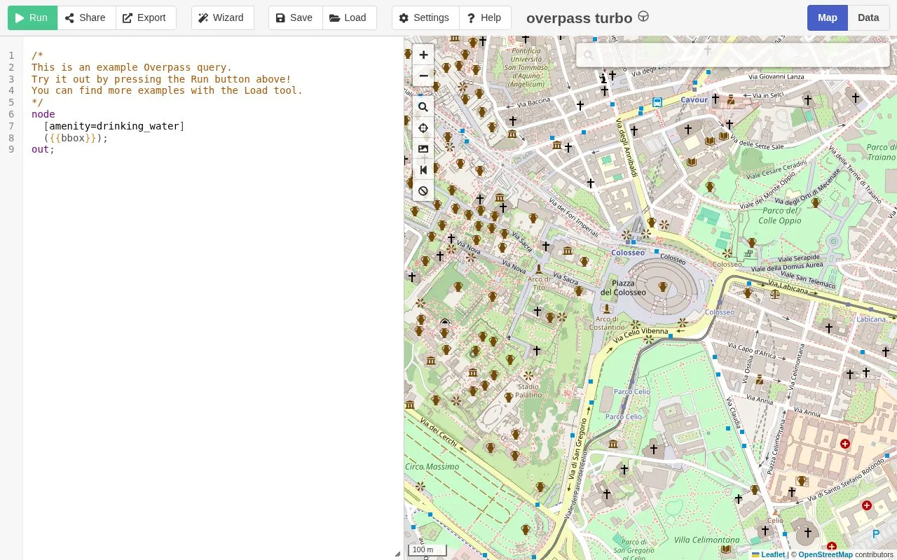
Overpass API GUI provides a graphical interface for querying OpenStreetMap data by map area.

overpass-turbo.eu
Overpass API GUI homepage screenshot

About Overpass API GUI

Overpass API GUI, also titled overpass turbo, is a web-based graphical interface for querying OpenStreetMap data by map area through the Overpass API. It provides map-area placeholders such as {{bbox}} and {{center}}, date and style placeholders, example queries, and keyboard shortcuts. Its use depends on browser support for Web Storage API and cross-origin resource sharing (CORS), and some browsers may need cookies or local data enabled. Recent Opera, Chrome, and Firefox versions have been tested, and the Overpass API query form is mentioned as an alternative.

Key features

  • Graphical interface for querying OpenStreetMap data by map area
  • Supports {{bbox}} and {{center}} placeholders for map-area queries
  • Supports {{date:…}} and {{style:…}} query placeholders
  • Includes example queries for drinking water, roads, hotels, and museums
  • Provides keyboard shortcuts for common actions
Best for: People who need a browser-based graphical way to query OpenStreetMap data by map area using the Overpass API.
Good for
  • Offers a graphical, map-area approach to querying OpenStreetMap data through Overpass API.
  • Includes query placeholders for bounding box, center, date, and style.
  • Lists example queries and keyboard shortcuts for common tasks.
Watch out for
  • Requires browser support for Web Storage API and CORS.
  • May require enabling cookies or local data in Firefox and Chrome.
  • Older or less capable browsers may not run significant parts of the application.

Overpass API GUI at a glance

Type
Website
Pricing
Not confirmed. Check the site
Platforms
Web
Open source
Not stated
Language
English
Last checked
Oct 5, 2026 · Online when checked
Listed
Oct 5, 2026

Overpass API GUI alternatives

Tools and sites you could use instead, ranked by how closely they match.

All 5 alternatives

FIRMS

firms.modaps.eosdis.nasa.gov/map

NASA FIRMS provides near-real-time active fire data from MODIS and VIIRS through downloads, maps, and area-based email alerts.

OpenTopoMap

opentopomap.org

OpenTopoMap displays topographic maps built from OpenStreetMap data for exploring terrain and locations.

Popular in Maps, Navigation & Weather

Well-known listings from the same topic.

All 203

Overpass API GUI FAQ

What browser features are required?
The application requires Web Storage API and cross-origin resource sharing (CORS) support.
Which browsers have been tested?
Recent versions of Opera, Chrome, and Firefox have been tested.
What can I use if my browser cannot run the app?
The Overpass API query form is noted as an alternative.
Is something wrong or out of date?

Tell us and an editor will check it.

Own this website?

Claim the listing and suggest updates yourself. An editor checks every claim first.

Claim this listing