

tornado.live maps tornado warnings and severe weather alerts across the United States.
Find Your Tornado Shelter
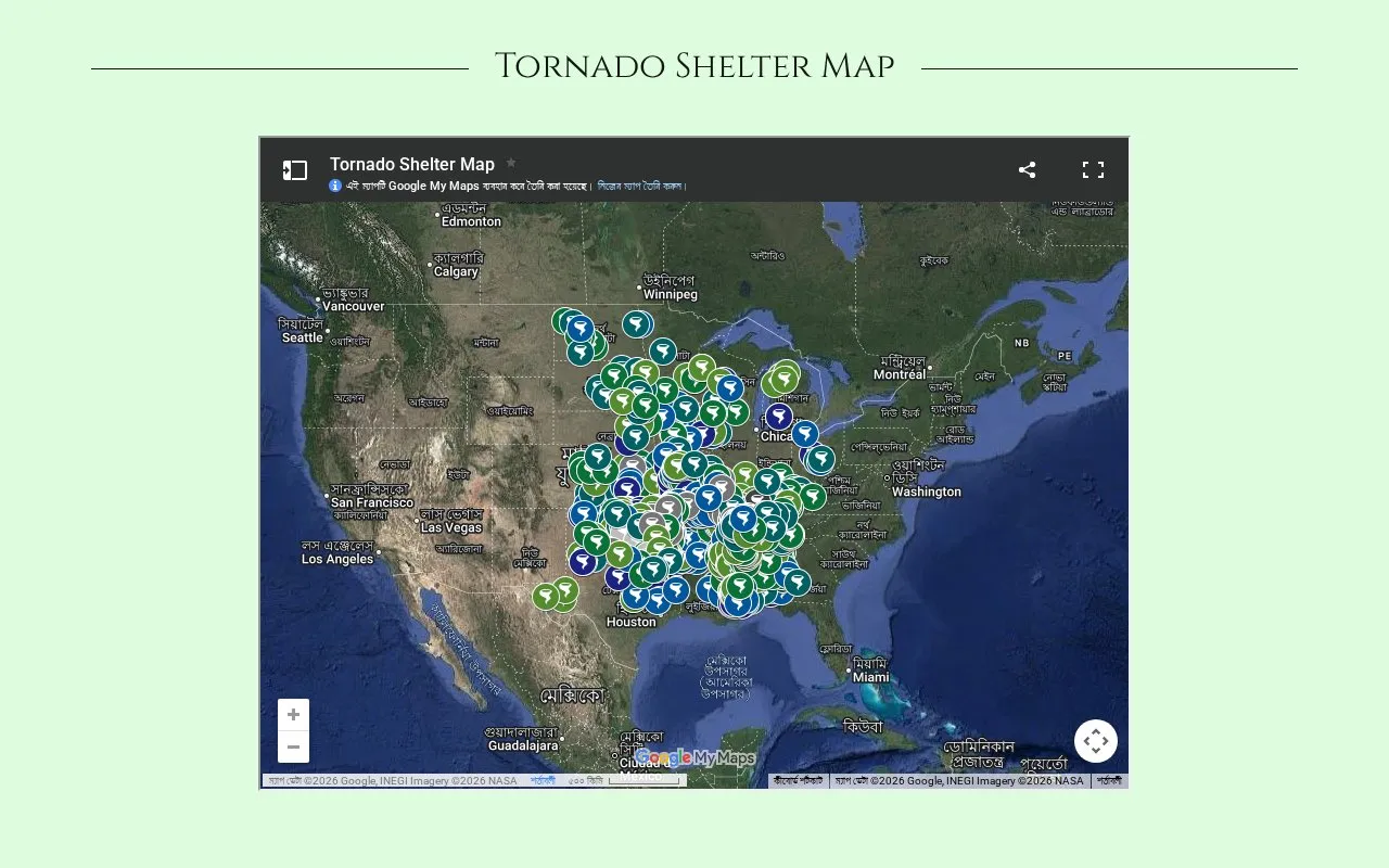
Find Your Tornado Shelter maps tornado shelter locations across the United States.
About Find Your Tornado Shelter
Find Your Tornado Shelter provides a map of tornado shelter locations across the United States, with a full-size map view and county information for contacting local governments or EMAs.
The site states that not all locations may be open for all events, users should confirm a shelter is open in advance and allow sufficient travel time, the map is subject to change without notice, and any commercial use must be authorized beforehand.
Key features
- U.S. tornado shelter map with full-size view option
- County listings for contacting local governments or EMAs
- Affiliate link to WeatherCall NexGen weather alerts
- Shelter data licensing for apps, operations and stations
- Contact option to join pre-order list for upcoming book
Best for: People in the United States who want to find tornado shelter locations and verify availability with local officials before severe weather.
Good for
- Covers tornado shelter locations across the United States
- Includes county information to contact local officials about shelter status
- Shelter data is licensed to multiple weather apps and stations
Watch out for
- Not all listed locations may be open for all events
- Map is subject to change without notice
- Travel after a tornado warning is issued may be too late
Find Your Tornado Shelter at a glance
- Website
- findyourtornadoshelter.com
- Category
- Travel & Maps › Maps, Navigation & Weather
- Type
- Website
- Pricing
- Not confirmed. Check the site
- Platforms
- Web
- Open source
- Not stated
- Language
- English
- Last checked
- Oct 5, 2026 · Online when checked
- Listed
- Oct 5, 2026
Find Your Tornado Shelter alternatives
Tools and sites you could use instead, ranked by how closely they match.

Historic Aerials provides aerial photographs and maps, including historic imagery for locations in the United States.
Freemium
15 alternatives
River Runner traces the path water would take from a selected location in the United States.
The Opportunity Atlas maps childhood origins and social mobility outcomes across the United States.

ACLED’s US Monitor provides coverage of protest and extremist activity in the United States.

MapChart lets users color custom maps of the world, regions, and states, add a legend, and download the result.
Popular in Maps, Navigation & Weather
Well-known listings from the same topic.
OpenWeatherMapopenweathermap.org511on.ca511on.caFIRMSfirms.modaps.eosdis.nasa.gov/mapWeather History & Data Archivewunderground.com/historyORBISorbis.stanford.eduEarth Engine Datasetdevelopers.google.com/earth-engine/datasets


Find Your Tornado Shelter FAQ
Should I check if a shelter is open before going?
Yes. The site states not all locations may be open for all events, so confirm they are open first and use the listed county to contact local governments or EMAs, and allow sufficient travel time.
Can I use the shelter map data for commercial purposes?
No. Any commercial use must be authorized by the author beforehand. Licensing options are available by contacting the site.
When will the Finding Your Shelter book be available?
The site states it should be available by the end of 2026 or the first quarter of 2027, with more information to be provided on release, and a pre-order list is available by contacting the site owner.
Is something wrong or out of date?
Tell us and an editor will check it.
Own this website?
Claim this listing
Claim the listing and suggest updates yourself. An editor checks every claim first.