

Skimap.org archives more than 29,000 ski resort trail maps from around the world, including historical maps.
Urbex
Urbex maps more than 1,000 urban exploration locations and asks visitors to respect laws and private property.
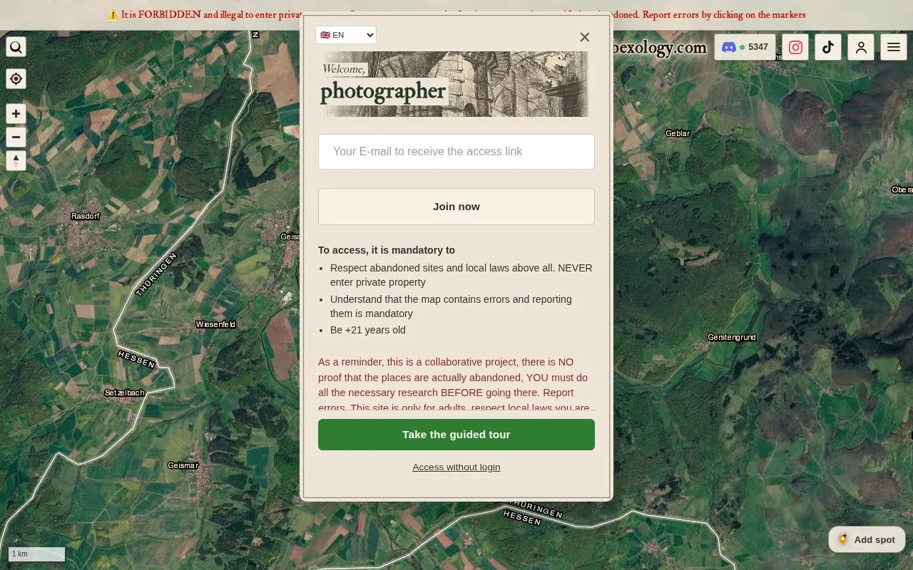
About Urbex
Urbexology is a collaborative map of more than 1,000 potentially abandoned places for urban exploration research. It offers map, satellite, terrain and 3D views with historical information, filters for forest locations, industrial zones and building area, alert zones for new spots, and options to add spots or report errors.
Use is limited to adults aged 21 and over and requires email verification. Positions are approximate and often obsolete, with no proof that places are abandoned, safe, or accessible. Users must do their own research, respect local laws and private property, not enter without permission, and report errors.
Key features
- Map, satellite imagery, terrain, and 3D view of locations
- Filter buildings by forest setting, industrial zone, and floor area
- Custom alert zone with notifications for new nearby spots
- Add new spots, including private spots, and report errors
- Link Discord account to collect points for contributions
- Access map information in multiple languages
Best for: Adults aged 21 and over who research architecture and local history and photograph locations from outside.
Good for
- Lists more than 1,000 potentially abandoned locations
- Provides satellite, terrain, 3D, and historical information
- Available on Android and web in multiple languages
Watch out for
- Collaborative listings contain errors and obsolete approximate positions
- Requires age 21 or older and email verification to access
- Does not establish public access, permission to enter, or safe conditions
Urbex at a glance
- Website
- urbexology.com
- Category
- Travel & Maps › Maps, Navigation & Weather
- Type
- Website
- Pricing
- Not confirmed. Check the site
- Platforms
- Android, Web
- Open source
- Not stated
- Language
- English
- Last checked
- Oct 5, 2026 · Online when checked
- Listed
- Oct 5, 2026
Urbex alternatives
Tools and sites you could use instead, ranked by how closely they match.

Falling Fruit maps collaborative urban harvest locations and food resources for nearby users.
London's Tree Map lets visitors explore more than 1.1 million public trees by species, location, and climate suitability.

WikiRoutes maps urban public transport and provides schedules, route search, and line distances.

Chronas lets visitors explore historical events and locations through a map of the world.

Dawarich offers a private alternative to Google Timeline and supports importing personal location history.
Free trial
Popular in Maps, Navigation & Weather
Well-known listings from the same topic.
OpenWeatherMapopenweathermap.org511on.ca511on.caFIRMSfirms.modaps.eosdis.nasa.gov/mapWeather History & Data Archivewunderground.com/historyORBISorbis.stanford.eduEarth Engine Datasetdevelopers.google.com/earth-engine/datasets


Urbex FAQ
Who can use Urbexology?
Only adults aged 21 and over who respect local laws, never enter private property, and accept full responsibility for their actions.
Are listed places definitely abandoned and safe to visit?
No. The database is collaborative with many errors and approximate obsolete positions. You must research each place, confirm you have the right to go there, look without entering, and report errors.
How do I get access to the map?
Complete verification by entering an email address to receive an access link. Check spam folders, as delivery can take up to 15 minutes and Hotmail addresses may be blocked.
Is something wrong or out of date?
Tell us and an editor will check it.
Own this website?
Claim this listing
Claim the listing and suggest updates yourself. An editor checks every claim first.