

Chronotrains shows where travelers can reach by train from a selected station.
FloodMap
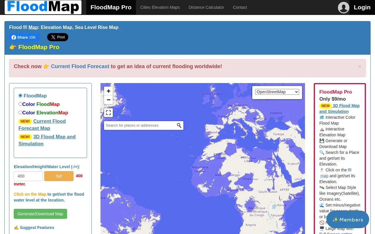
FloodMap shows areas that could be flooded and provides current flood forecast information.
About FloodMap
FloodMap shows areas below a user-set water level in meters to illustrate possible flooding, sea-level rise effects, and elevation. It provides color flood and elevation views, a current flood forecast map, 3D flood map and simulation, place search and map-click to get or set elevation, multiple base map styles, and negative values for coastal depth and bathymetry study.
The application does not show current or historic flood levels, only areas below the set elevation, and is stated as not sufficient on its own for flood-risk analysis. Complete and larger views require a FloodMap Pro subscription, and the application is not guaranteed free of bugs or inaccuracies.
Key features
- Set water level in meters to show areas below elevation
- Display current flood forecast map for worldwide flooding
- Show 3D flood map and simulation
- Search place or click map to get and set elevation
- Switch between satellite, topographic, oceans and other base maps
- Set negative values for ocean depth and bathymetry study
Best for: People who want to check how a set water level, elevation, or sea-level rise relates to specific places.
Good for
- Provides worldwide current flood forecast view alongside elevation-based flood display
- Supports multiple base map styles and color palettes
- Lists flood maps and elevation maps by country and city, town or village
Watch out for
- Does not show current or historic flood levels, only areas below set elevation
- Stated as not sufficient on its own for flood risk analysis
- Complete and larger view requires FloodMap Pro subscription
FloodMap at a glance
- Website
- floodmap.net
- Category
- Travel & Maps › Maps, Navigation & Weather
- Type
- Website
- Pricing
- Paid
- Platforms
- Web
- Open source
- Not stated
- Language
- English
- Last checked
- Oct 5, 2026 · Online when checked
- Listed
- Oct 5, 2026
FloodMap alternatives
Tools and sites you could use instead, ranked by how closely they match.
Orhyginal’s map catalogs external cartographic tools and can position them automatically to the current map extent.

Project '44 provides a free interactive map of the Second World War with historical mapping information.

NASA Global Maps show how key parts of Earth’s climate system change from month to month.

NASA’s climate resources explain Earth’s changing climate and its study through the agency’s science programs.
London's Tree Map lets visitors explore more than 1.1 million public trees by species, location, and climate suitability.
Popular in Maps, Navigation & Weather
Well-known listings from the same topic.
OpenWeatherMapopenweathermap.org511on.ca511on.caFIRMSfirms.modaps.eosdis.nasa.gov/mapWeather History & Data Archivewunderground.com/historyORBISorbis.stanford.eduEarth Engine Datasetdevelopers.google.com/earth-engine/datasets


FloodMap FAQ
Does FloodMap show current or historic flood levels?
No. It shows all areas below the elevation level that is set.
What units and reference does the elevation use?
Elevation is in meters from sea level, where zero is sea level and negative values mean depth below sea level.
What elevation data sources are listed?
Mazpzen, TNM, SRTM, GMTED and ETOPO1.
Is something wrong or out of date?
Tell us and an editor will check it.
Own this website?
Claim this listing
Claim the listing and suggest updates yourself. An editor checks every claim first.