

Earth displays forecast wind, weather, ocean, and pollution conditions on an animated global map updated every three hours.
Light Pollution Map
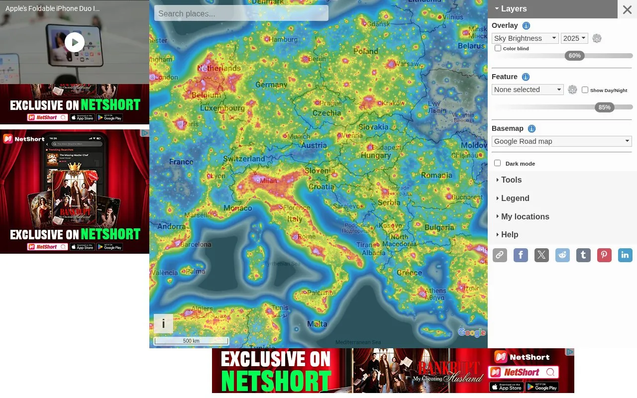
Light Pollution Map uses NASA data to display global light pollution and sky brightness layers.
About Light Pollution Map
Light Pollution Map is an interactive world map that displays light pollution using NASA Black Marble VIIRS data, sky brightness layers, and World Atlas 2015. It also shows clouds, aurora forecasts, observatories, dark sky parks, and SQM/SQC measurements contributed by users.
Tools include point and area queries, distance measurement, sky brightness simulation, finding the closest dark site, and adding SQM measurements or markers. Hover readout of VIIRS and sky brightness values is available at zoom level 8 and above.
Key features
- VIIRS and VIIRS Trend layers with yearly data 2012-2025
- Sky brightness and World Atlas 2015 overlays
- Clouds and aurora forecast layers
- User-contributed SQM and SQC measurement overlays
- Observatory and dark sky park locations with filters
- Tools to measure distance and query point or area values
Best for: People looking for dark-sky locations for stargazing, astrophotography, or observatory visits.
Good for
- Combines VIIRS, sky brightness, clouds, aurora, and observatory layers
- Includes user-contributed SQM and SQC measurements
- Offers point, area, distance, and closest dark site tools
Watch out for
- Hover values require zoom level 8 or higher
- Moon widget is marked as experimental
Light Pollution Map at a glance
- Website
- lightpollutionmap.info
- Category
- Travel & Maps › Maps, Navigation & Weather
- Type
- Website
- Pricing
- Not confirmed. Check the site
- Platforms
- Web
- Open source
- Not stated
- Language
- English
- Last checked
- Oct 5, 2026 · Online when checked
- Listed
- Oct 5, 2026
Light Pollution Map alternatives
Tools and sites you could use instead, ranked by how closely they match.

Xweather displays global weather with real-time radar layers and forecast information.

World Population Density maps population patterns and urban regions using Global Human Settlement Layer data.

Explore light pollution estimates, Bortle classes, and dark-sky locations on an interactive map.
CPRE's map presents information about light pollution and dark skies across England.

NASA Global Maps show how key parts of Earth’s climate system change from month to month.
Popular in Maps, Navigation & Weather
Well-known listings from the same topic.
OpenWeatherMapopenweathermap.org511on.ca511on.caFIRMSfirms.modaps.eosdis.nasa.gov/mapWeather History & Data Archivewunderground.com/historyORBISorbis.stanford.eduEarth Engine Datasetdevelopers.google.com/earth-engine/datasets


Is something wrong or out of date?
Tell us and an editor will check it.
Own this website?
Claim this listing
Claim the listing and suggest updates yourself. An editor checks every claim first.