

VR's live train tracker maps train movements using GPS tracking and data from Finland's rail infrastructure agency.
Livecorona.co.kr
Livecorona.co.kr shares COVID-19 information, health guidance, case statistics, and spread maps based on public health agency data.
About Livecorona.co.kr
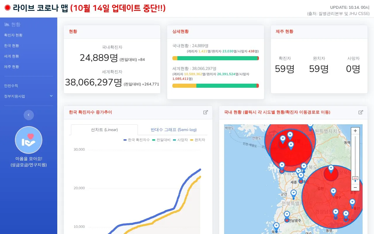
Livecorona.co.kr is a Korean-language information site about COVID-19. It presents case counts, health guidance, and spread maps for Korea, Jeju, and the world. The homepage states that its data is based on public health agency sources, including the Korea Disease Control and Prevention Agency (KDCA) and the Central Disaster Management Headquarters. It also cites KBS and WHO for some figures.
The site combines statistical charts, a world map of cases, news links, and a directory of testing clinics and health centers in Jeju. Some pages, such as the disease comparison table, are labeled as 2020 data. The homepage notes that case figures may differ from municipal tallies at a given time.
Key features
- Domestic and worldwide COVID-19 case, recovery, and death counts
- Linear and semi-log charts of daily case trends in Korea
- World map showing cases by country, with clickable details
- Age-group case and fatality analysis for Korea, citing KDCA
- Jeju movement records and a Jeju health center directory
- Comparison table of COVID-19, SARS, MERS, and H1N1 figures
Best for: People in Korea, especially Jeju residents, who want Korean-language COVID-19 statistics and nearby testing clinic information.
Good for
- Lists its data sources, including KDCA and WHO, on the homepage
- Provides a searchable directory of Jeju health centers with phone links
Watch out for
- News sections pull real-time results without human selection
- Figures may differ from local government tallies at a given time
- Some comparison data is labeled as 2020 and may not be current
Livecorona.co.kr at a glance
- Website
- livecorona.co.kr
- Category
- Travel & Maps › Maps, Navigation & Weather
- Type
- Website
- Pricing
- Not confirmed. Check the site
- Platforms
- Web
- Open source
- Not stated
- Language
- Korean
- Last checked
- Oct 6, 2026 · Online when checked
- Listed
- Oct 5, 2026
Livecorona.co.kr alternatives
Tools and sites you could use instead, ranked by how closely they match.

WikiRoutes maps urban public transport and provides schedules, route search, and line distances.

NASA FIRMS provides near-real-time active fire data from MODIS and VIIRS through downloads, maps, and area-based email alerts.
Pick
24 alternatives
NCEI maps and geospatial tools visualize data types together and relate variables to specific locations.

CellMapper maps cellular towers and coverage from crowdsourced data, with filters for providers and regions.
Notable People maps birthplaces using data about people identified as notable in a research dataset.
Popular in Maps, Navigation & Weather
Well-known listings from the same topic.
OpenWeatherMapopenweathermap.org511on.ca511on.caWeather History & Data Archivewunderground.com/historyORBISorbis.stanford.eduEarth Engine Datasetdevelopers.google.com/earth-engine/datasetsAP Transitaptransit.co


Livecorona.co.kr FAQ
Where does the case data come from?
The homepage says the data is based on public health agency sources, including the Korea Disease Control and Prevention Agency and the Central Disaster Management Headquarters. Some figures are attributed to KBS or WHO. The site notes that numbers may differ from municipal counts at a specific time.
Are the news links selected or reviewed by the site?
No. The homepage states that the Naver and Google news sections show real-time results and that no topic-based selection is done.
How can I find a testing clinic?
The site includes a map of COVID-19 screening clinics and health centers. In the Jeju health center list, each entry includes an address and phone number, and the map allows calling some locations directly.
Is something wrong or out of date?
Tell us and an editor will check it.
Own this website?
Claim this listing
Claim the listing and suggest updates yourself. An editor checks every claim first.